Skadi Series™ GNSS
Next-generation receivers with integrated antenna and shapeshifting design
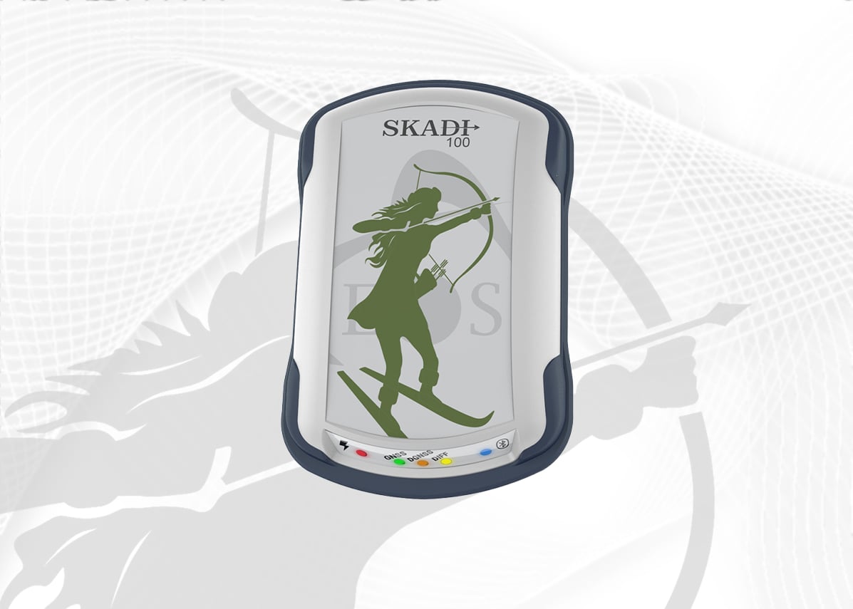
Skadi 100™
Submeter60cm accuracy with SBAS. Entry-level for GIS mapping.
- Multi-frequency
- All major constellations
- Handheld design

Skadi 200™
Entry-Level RTKDual-frequency RTK for reliable centimeter positioning.
- Dual-frequency L1/L2
- Smart Handle™ ready
- Tilt compensation

Skadi 300™
Triple-Freq RTKFaster RTK initialization in challenging environments.
- Triple-frequency L1/L2/L5
- Smart Handle™ ready
- Tilt compensation

Skadi Gold™
All-Freq All-Signal RTKMaximum flexibility with all corrections & PPP options.
- All frequencies & signals
- Galileo HAS & Atlas®
- PPP & all corrections
Arrow Series® GNSS
Professional receivers for mobile GIS with external antenna flexibility
Arrow 100+®
SubmeterMulti-constellation submeter for demanding workflows.
- All constellations
- Multi-frequency
- All-day battery
Arrow 200+®
Entry-Level RTKAffordable RTK with centimeter positioning.
- Dual-frequency L1/L2
- RTK/NTRIP support
- SafeRTK™
Arrow Gold+®
All-Freq All-Signal RTKPremium RTK with all signals and corrections.
- All frequencies & signals
- Galileo HAS & Atlas®
- PPP & all corrections
Arrow Lite®
SubmeterEntry-level submeter GNSS for basic mapping.
- Multi-frequency
- Bluetooth
- Compact design
Arrow 100®
SubmeterProfessional submeter with all constellations.
- All constellations
- Multi-frequency
- All-day battery
Arrow 200®
RTKDual-frequency RTK for centimeter accuracy.
- Dual-frequency L1/L2
- RTK/NTRIP support
- SafeRTK™
Arrow Gold®
All-Freq All-Signal RTKPremium RTK with all signals and corrections.
- All frequencies & signals
- Galileo HAS & Atlas®
- PPP & all corrections
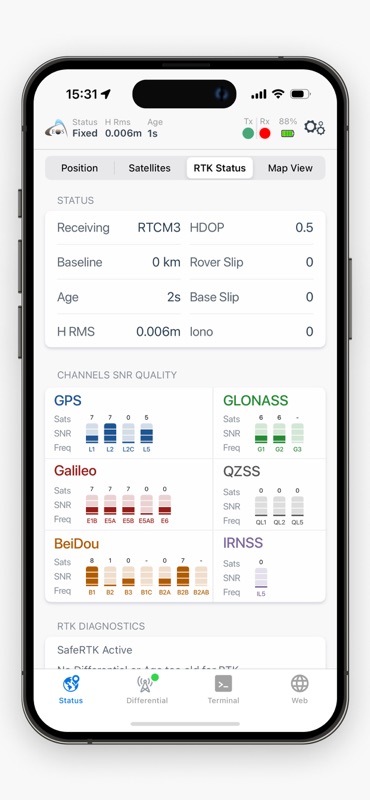
 Eos Tools Pro
The essential companion app for all Eos GNSS receivers. Everything you need to configure, monitor, and get the most from your receiver.
- Configure receiver settings and RTK corrections
- Stream high-accuracy positions to GIS apps
- Monitor satellite status and accuracy in real-time
- Manage NTRIP connections and corrections
- Update firmware over-the-air


Solutions
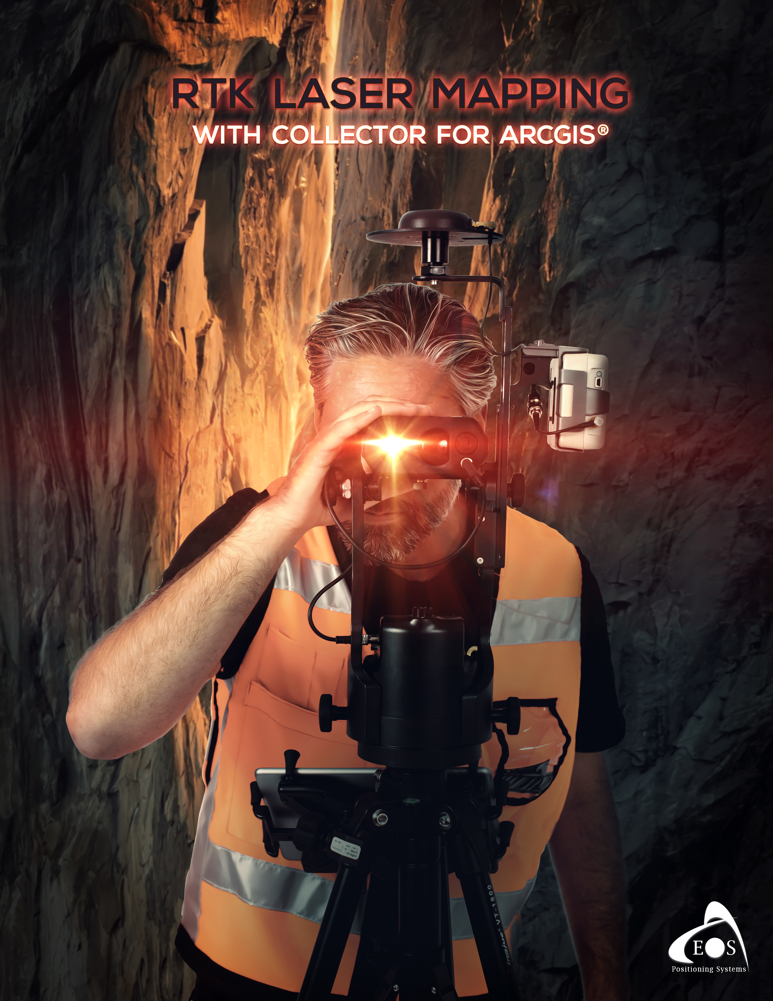
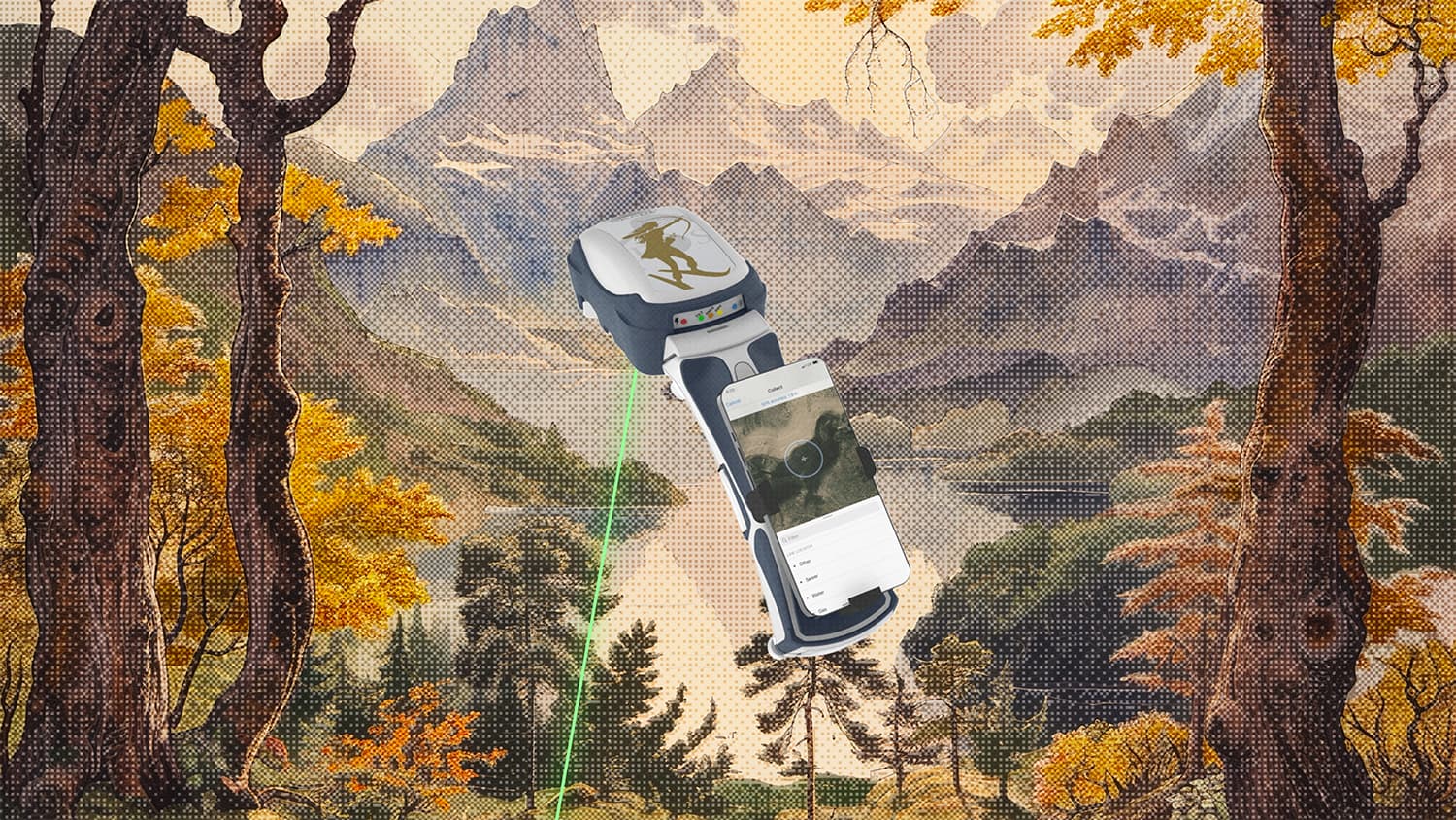
Eos Laser Mapping™Free
Map hard-to-reach assets with 3D survey-grade accuracy from hundreds of meters away. Perfect for GNSS-impaired or hazardous locations.

Eos Locate™Free
Real-time underground utility mapping with survey-grade accuracy. Locate and map buried infrastructure directly into ArcGIS.

Eos Bridge™
Universal Bluetooth connector for third-party instruments. Connect laser rangefinders, depth sounders, and other sensors.
Compatible Apps
Find integration guides for your mapping application